Among natural hazards, flash floods belong to the most devastating in terms of losses of life and property. Understanding the generation and controls of such extreme hydrologic phenomena is necessary to improve our prediction ability and develop more accurate warning systems.
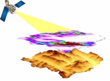
Animated representation of satellite (figure from NASA) measuring rainfall over a complex terrain basin in Eastern Italian Alps.
Traditionally, researchers have used lumped models to predict rainfall-to-runoff transformation at the outlet of a basin. However, due to the complexity of basin’s hydrologic response, the heterogeneous generation of runoff and the localized character of flash floods, the importance of modeling/representing the spatial dynamics of hydrologic processes was quickly recognized. This necessity, along with the availability of distributed information (precipitation fields, soil and land use maps etc.) enhanced the development of distributed hydrologic models (DHM).
One of the great advantages of DHM is that they do not require long records of hydrologic observations for calibration, thus making them favorable for applications on remote mountainous regions (that are usually prone to flash floods) where in situ data are inexistent or sparse.
|
The capability of DHM to utilize distributed input (basin characteristics and meteorological variables) and provide spatial information of hydrologic variables (e.g. runoff, soil moisture) allows studying the relationships and sensitivity of hydrologic response to control parameters such as initial soil moisture, land use/cover, precipitation spatial distribution etc.
Advancements in space-based precipitation observations have opened new horizons in hydrological applications at global scale. The use of satellite-rainfall to force DHM can potentially create a flood warning system with applications over ungauged watersheds, transnational basins etc. However, several issues need to be investigated in order to understand and evaluate the use of satellite-rainfall in flood prediction.
Researchers at HCMR focus on a number of research topics that include: i) use of DHM to predict floods in complex terrain, ii) modeling of hydrologic processes in order to understand runoff generation mechanisms and the parameters that control flash flood initiation, ii) sensitivity of flood peaks to initial soil moisture conditions and land cover, iii) analysis of the propagation of satellite-rainfall error through DHM and its dependence to a) basin scale and b) satellite-rainfall spatiotemporal resolution.
Answers to those questions will enhance significantly our understanding on flash flood generation and provide a comprehensive assessment on the use of satellite observations for flood predictions in complex terrain. Moreover, successful modeling of the hydrological processes at a watershed scale can serve as a useful tool for warning systems and reservoir management.
|